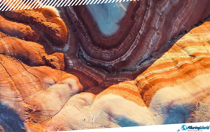
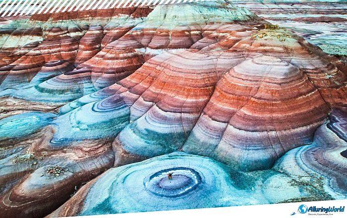
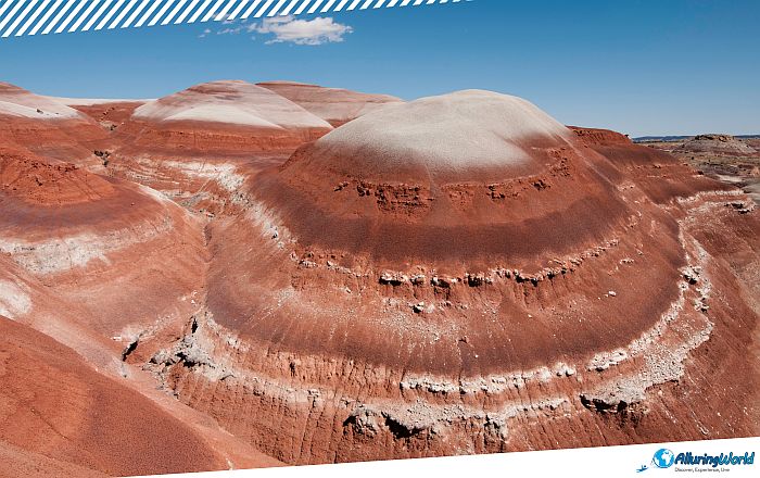
The Bentonite Hills are a surreal, colorful band of rolling clay and shale hills that appear as if they are from another planet, located deep in the heart of Wayne County, in the central part of the State of Utah, within the southwestern part of the United States of America. As this otherworldly landscape appears so starkly alien, the Bentonite Hills border Capitol Reef National Park, and they feature soft, rolling hummocks painted in brilliant horizontal bands of deep purple, burnt terracotta, slate blue, and pale ochre. While photographs of these colorful mounds have taken social media by storm in recent years, reaching and properly experiencing this remote terrain requires careful preparation, clear environmental awareness, and an understanding of the complex desert conditions. It does not matter if you are a fearless road tripper, an avid landscape photographer who seeks that elusive low light shot, or just a curious visitor who treks through the slickrock wilderness of southern Utah; when you are venturing through the Bentonite Hills, you will be required to have a healthy dose of respect and appreciation for the scenery and the ecosystem that supports it.
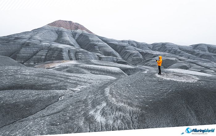
The impressive nature of the Bentonite Hills results from a story told by geology that starts some 150 million to 157 million years ago. During this time, some active volcanic chains to the west were spreading huge quantities of ash into wide floodplains, and through millions of years, this layer of volcanic ash got mingled with silt, sand, and organic mud in the Brushy Basin Member of the Morrison Formation, thus preparing the ground to form the Bentonite Hills. As the volcanic ash weathered, the substance would chemically change into bentonite clay, a specialized compound rich in smectite minerals. What makes bentonite distinctive in its form is the extreme tendency for it to attract moisture; thus, when it rains, the clay will suck up raindrops like a sponge does, expanding many times over. When the clay dries under the fierce heat of the Utah sun, the clay contracts again, leaving soft, rounded formations devoid of vegetation underneath them.
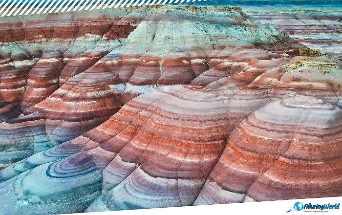
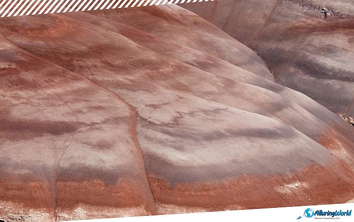
But the striking and colorful stripes found here are the product of different mineral compositions and oxidation levels. Iron compounds produce rich reds, pinks, and rusted purples, while the presence of manganese and organic matter in small quantities creates shades of blue, gray, and green. Since the clay is soft and does not contain any layers of rock, erosion by water and wind is constantly shaping the hills into organic forms, which contrasts greatly with the vertical sandstone formations common in the Colorado Plateau region.
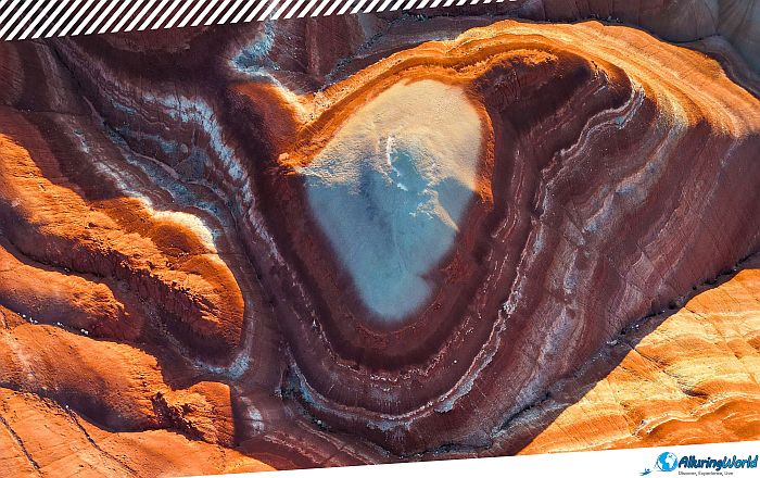
When you are deciding and investigating where the Bentonite Hills are located, a frequent point of confusion is that two distinct areas in southern Utah are commonly referred to as the “Bentonite Hills.” While you must have an idea of which specific place you want to visit, there are few distinct locations in the badlands east of Capitol Reef National Park that can be referred to by the same name. Distinguishing between them is essential, as access requirements and local land management regulations differ significantly. For a better understanding, these are the two main places that you would want to visit:
- The Hanksville Site (Near the Mars Desert Research Station): Situated to the northwest of Hanksville on Cow Dung Road, this site falls within public land controlled by the Bureau of Land Management (BLM). It is the most easily accessible site, since there are no river crossings involved and no deep backcountry navigation under dry conditions. As it falls beyond the jurisdiction of national parks, the use of drones for recreational purposes is allowed here, although this is still subject to following the FAA regulations and maintaining a safe distance from the research facilities located nearby.
- Note: While drone filming is allowed at the Hanksville site, any commercial video production requires a BLM special use permit.
- The Cathedral Valley Site (Inside Capitol Reef National Park): Located inside the northern, remote Cathedral Valley District of Capitol Reef National Park, these hills form part of the Hartnet Road loop. They feature taller, steeper, brown/tan layered domes, which are not as picturesque as the Hanksville Site, but still worth a visit. Reaching this area requires a high-clearance, four-wheel-drive vehicle capable of fording the unpredictable currents of the Fremont River near Caineville. The river needs to be under 30 centimeters (1 foot) for safe vehicle passage. Furthermore, drone usage is strictly prohibited across all U.S. National Parks, including this location.
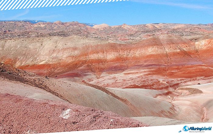
Once you’ve decided which place you’d like to see, you should prepare yourself for the desert trip of a lifetime. Desert environments are defined by extremes, and the Bentonite Hills are no exception to this rule. Choosing the right time of year and day will directly shape your experience, safety, and photography outcomes. The best seasons to visit the Bentonite Hills near Hanksville Site are during springtime and autumn, which run between March and May, and September through November, respectively. Daytime temperatures during these shoulder seasons range comfortably between 15°C and 25°C (59°F to 77°F), thus making outdoor exploration enjoyable and your experience very satisfying.
ADVERTISEMENT
If you want to visit during the summertime period, which runs between June and August, be aware that this will bring brutal desert heat, with temperatures regularly soaring past 38°C (100°F). Since there is no natural shade in the badlands, and thermal radiation radiating off the dark clay can make midday conditions dangerous, it is not recommended that you visit the hills during this period. Additionally, summer coincides with Utah’s monsoon season, which brings sudden, violent afternoon thunderstorms that make the terrain impassable and even dangerous when you try to go with your vehicle.
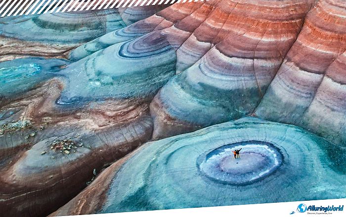
Winter, on the other hand, runs between December and February and brings crisp solitude and occasional dustings of snow that create a beautiful contrast against the dark colors of the hills. Nevertheless, winter temperatures often fall below 0°C (32°F), and freezing night air can trap moisture in the clay, thus leading to icy or muddy road conditions that linger into late morning. If you arrive at the Bentonite Hills under direct, harsh midday sunlight, you might be surprised by how muted the terrain appears, as the colors will seem very dull and uninteresting to you. The reason for this is the high glare of the sun, which washes out the delicate saturation of the clay, leaving the hills looking dull gray or pale reddish-brown.
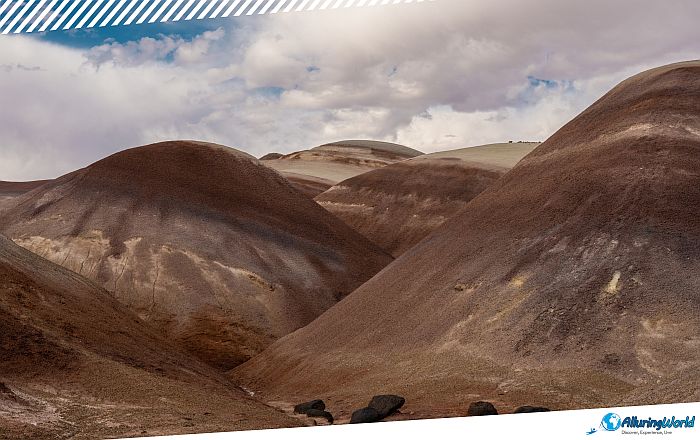
In order to capture the vibrancy of the colors, you need to plan your visit during the “Blue Hour,” which is around 30-45 minutes either before sunrise or after sunset. In this span of time, the atmosphere functions as a giant soft box that diffuses cool blue light over the Earth. Under the sky-lighting conditions, the blues, purples, and magenta of the clay surface glow with a bioluminescence effect. Once you are there during this magnificent hour, here are some key photography tips to follow:
- Bring a sturdy tripod to accommodate the slower shutter speeds needed during blue hour illumination. You will be able to leave your camera on the tripod, and it will capture a magnificent moment that your eye might miss.
- If you choose to do the sunset Blue Hour, then consider packing a headlamp with a red-light mode so you can safely hike back to your vehicle at 20:30 or navigate out at 05:30 without losing night-vision adaptation.
- If you want to get the greatest details ever, then use telephoto focal lengths (70mm to 200mm) to isolate geometric patterns, rolling textures, and intersecting color bands without needing to walk onto pristine slopes.
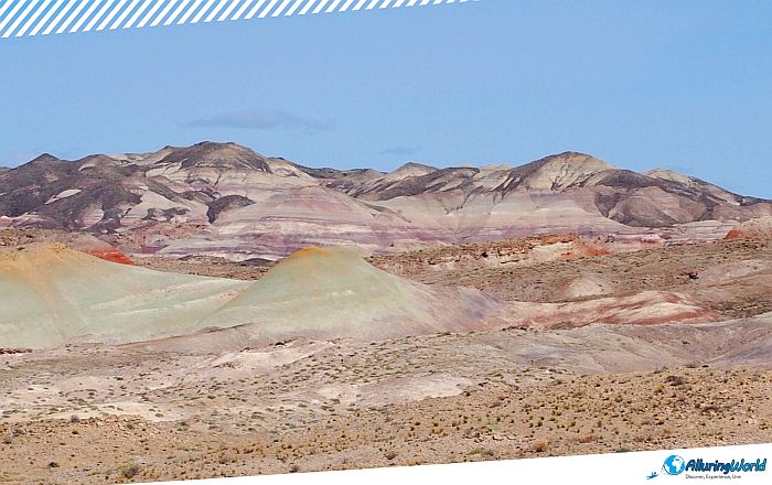
The defining rule of traveling through bentonite country is simple: never drive on or walk through wet bentonite clay. When bentonite clay absorbs water, it loses all structural stability, and it turns into a slick, sticky paste often called “gumbo mud”. This slurry packs tightly into tire treads within seconds, consequently turning off-road tires into smooth slick blocks and stripping vehicles of all traction. Even equipped four-wheel-drive trucks easily slide off banked dirt roads into washes when roads are wet. Do NOT attempt to drive unpaved access roads (such as Cow Dung Road) during or immediately following rain or snowmelt, as vehicles will become completely immobilized and stranded without cellular service.
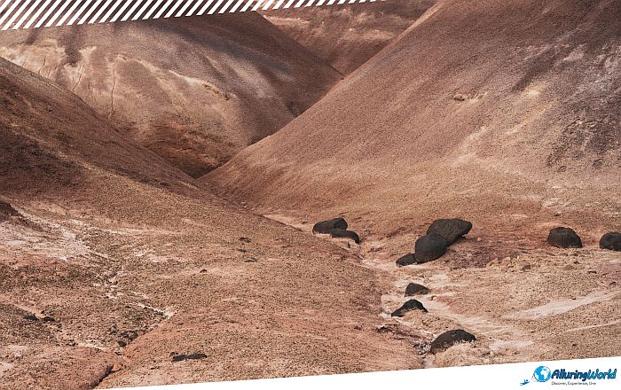
You must always check current conditions with the local Bureau of Land Management office in Hanksville prior to your departure. Tow truck recoveries in this remote region are exceptionally difficult to secure and can easily cost thousands of dollars. In totally dry conditions, the primary gravel access road leading to the Mars Desert Research Station from Highway 24 will be passable to normal cars when driven carefully. Overall, high clearance vehicles are highly recommended when traversing ruts of washes, rocks, and washouts created by previous flash floods.
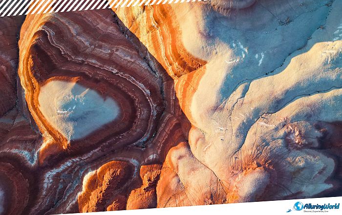
Despite its rugged, barren appearance, the desert surface of the Bentonite Hills is remarkably fragile, which is why you should be considerate where you go and how you drive. The same expansion-and-contraction cycle that shapes the clay also forms a delicate crust across the topsoil. Footprints and vehicle treads that compact moist or pliable bentonite soils create irreversible damage to the soil’s internal structures. In such an arid setting, the print of even one footstep not along an established path is visible for several decades at a stretch, and it invites erosion from water as well as visual damage. Moreover, the terrain here serves as the natural home for the threatened Wright fishhook cactus (Sclerocactus wrightiae). You should always practice the Leave No Trace ethical framework and consider the following:
-
- Walk exclusively within dry wash beds, along established dirt road shoulders, or on clearly hardened surfaces.
- Never climb or scramble up the soft, untouched clay slopes, no matter how tempting the photo angle might seem.
- Pack out every piece of trash, including organic waste like fruit peels, which decompose very slowly in high desert climates.
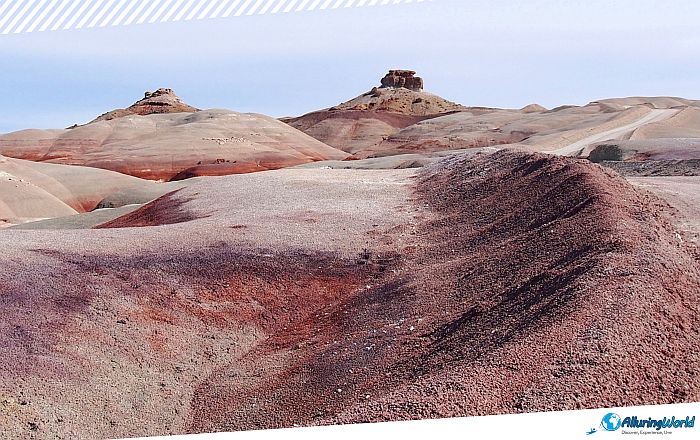
Because cell phone coverage drops off rapidly once you turn off Utah State Route 24, self-reliance is vital when venturing into the badlands around Hanksville. Ensure your vehicle is stocked with basic emergency supplies before setting out, but make sure you double-check that you have:
- At least 4 liters (1 gallon) of drinking water per person per day.
- Offline navigation maps downloaded via mobile apps or a dedicated satellite GPS device.
- A full-sized spare tire, a working tire jack, and a tire pressure gauge.
- High-SPF sunscreen, wide-brimmed sun hats, and UV-blocking sunglasses.
- A fully charged portable power bank for cameras, phones, and lighting gear.
One of the greater and more interesting things that can be seen here is the Mars Desert Research Station (MDRS). Located right on the Cow Dung Road, in the middle of the Hanksville area, this facility is owned and managed by the Mars Society. MDRS is a field research station that is used to simulate the environment on Mars and prepare people for the Red Planet.
When you are at the station, you get that sense of being somewhere out of this world, seeing the stark white modules of the facility among the purple and red clay hills, but you have to observe the rules of the facility:
- Strictly Closed to the Public: The MDRS is an active, private research facility. There are no public tours, walk-ins, or visits inside the habitat modules or observatories, and they are not permitted under any circumstances.
- Perimeter Rules: You are welcome to view and photograph the station from a distance from public BLM pull-outs along Cow Dung Road, or from existing, established dirt road shoulders. Do not scramble up surrounding untouched hills to view the campus. Do not cross marked property lines, step onto the campus, or disturb active crews, to avoid penalties and other consequences.
- Drone Etiquette: While recreational drones are allowed on surrounding BLM land, flying directly over or near the MDRS campus is strictly prohibited. Pilots must maintain high altitude and keep a significant distance from the station in order to protect ongoing research and crew privacy.
The easiest approach to get to the accessible site of Hanksville is to drive towards the town of Hanksville along Utah State Route 24. Then from there, continue driving west on Utah State Route 24 (SR-24) for about 6.5 kilometers (4 miles) before turning north onto Cow Dung Road (BLM Road 110). Finally, travel north for an estimated distance of 9.5 kilometers (5.9 miles). As you get near the research station, please remember that the MDRS is a private, operational research station that provides researchers the opportunity to experience life as if they were on the red planet. Be gentle when driving your car, so you do not stir up any dust, and remember not to walk onto the facilities’ grounds.
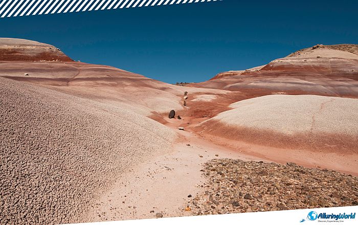
In summary, the Bentonite Hills in Utah provide an amazing chance to enter the ancient and otherworldly time tunnel of the Western United States. By considering the natural lighting conditions in the evening and being wary of changing weather patterns, along with protecting the vulnerable surface layer of the Earth, you will be able to see one of the most stunning visual phenomena of southern Utah, and perhaps in the entire world.