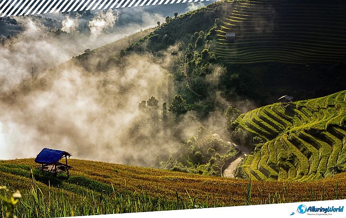
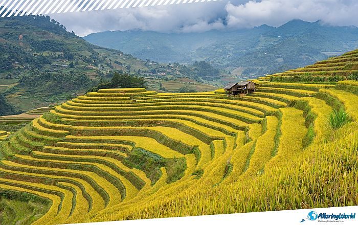
Mù Cang Chải Rice Terraces are a vast, hand-sculpted agricultural landscape composed of numerous rice terraces located in the Mù Cang Chải District of Yên Bái Province, within the northwestern part of the Socialist Republic of Viet Nam. Being part of mountains that rise sharply out of narrow river valleys, the landscape unfolds into an extraordinary mosaic of engineered hillsides translated into the Mù Cang Chải Rice Terraces. Located roughly 300 kilometers (186 miles) northwest of the capital city of Hanoi near the formidable Hoàng Liên Sơn mountain range, this region transforms what should be inhospitable terrain into one of the world’s most spectacular agricultural achievements.
Instead of just being a single viewing point, Mù Cang Chải is a complex network of sculpted terrain that covers thousands of hectares. The area can be described as a model of ancient land management and engineering, but besides the impressive visual pattern, you will be offered a glimpse of the culture of northern Vietnam’s highland minorities. The history of Mù Cang Chải terraces is closely related to the H’Mong people who have been residing in these mountainous regions for centuries. According to local history and national heritage, the H’Mong people have been growing these terraces for over twenty generations now. However, the construction of the terraces was not the outcome of a single grand municipal blueprint. Rather, it grew out of necessity and developed gradually from that point onward. Because the H’Mong people were forced to live at increasingly higher altitudes as a consequence of their migration and geographical location, they were faced with an important problem: rice cultivation needed water and a flat surface.
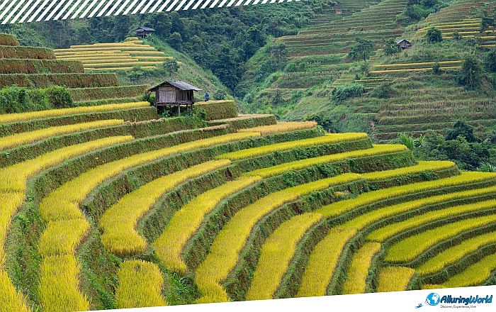
To overcome this, farmers began painstakingly carving horizontal shelves out of the steep clay mountainsides and slowly created this amazing agricultural landscape. Each terrace had to be meticulously leveled by hand using manual tools, followed by the construction of dense, compacted earthen rims to hold back soil and rain runoff. Passing this specialized knowledge down from parent to child, successive generations expanded, repaired, and perfected the terraces. Over hundreds of years, individual family plots gradually merged into entire mountainsides of fluid, cascading fields.
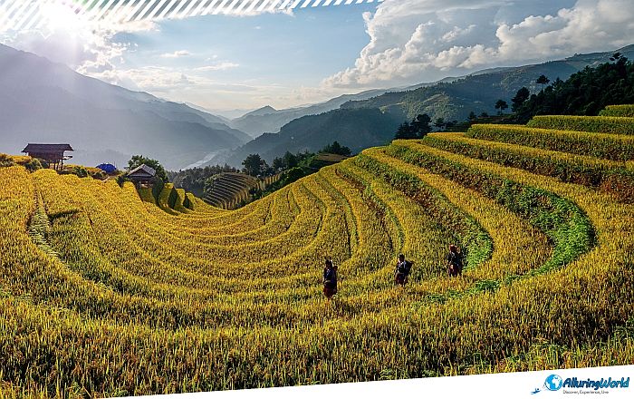
To gain an appreciation of the magnitude of Mù Cang Chải, you must look beyond the aesthetics and realize how complex the hydrology is, which keeps the ecosystem running smoothly. A mountain terrace is a functioning hydrological system, and any mismanagement of the water could lead to erosion or even landslides. The H’Mong people have devised an extremely efficient irrigation system based on gravity that makes use of mountain streams and bamboo pipes. The water is collected from elevated positions and fed into specially made channels which lead the water down the mountain slopes. The water first fills up the highest level of the terraced fields, covers the land up to the precise depth needed by the rice plants, and then flows down through notches into the next level.
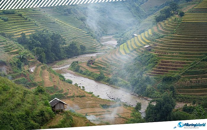
Keeping such a system requires hard labor all the time, and the H’Mong people had their patience with this entire process. Prior to each planting season, the farmers have to break down the tough soil of the mountains, repair the retaining walls that might be damaged due to winter frosts, and clean the irrigation canals of any debris. Such a perfect mix of soil science and gravity flow is an example of sustainable land management that has survived for centuries.
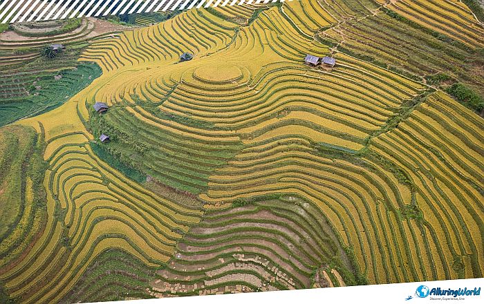
Quantifying the total area of Mù Cang Chải is based on administrative boundaries, and it can be said that the larger agricultural zone that the whole area of Mù Cang Chải covers is about 2,000 hectares (4,940 acres). Nevertheless, the historical center known for its beautiful aesthetics and culture covers three main communes: La Pán Tẩn, Chế Cu Nha, and Dế Xu Phình. The Vietnamese Ministry of Culture, Sports and Tourism recognized the area covering 330 hectares (815 acres) in these three communes as a National Scenic Heritage site in 2007. Realizing that the area had greater cultural significance and thus required proper protection from overexploitation, the Vietnamese government conferred the area with an even higher status of Special National Relic in 2019. This encompassed the following places:
- Core Heritage Communes: La Pán Tẩn, Chế Cu Nha, and Dế Xu Phình.
- Key Visual Landmarks: Mâm Xôi Hill (“Raspberry Hill”), Horseshoes Curve, and Khau Phạ Pass.
- Protection Level: Special National Relic (Designated 2019).
ADVERTISEMENT
Having this formal status ensures that conservation efforts protect the physical structures of the terraces and the traditional farming practices required to keep them intact, thus preserving them for future generations to cultivate their own food and allowing visitors to have a glimpse of a Vietnamese history that should not be missed. When you are visiting Mù Cang Chải Rice terraces, their appearance changes dramatically depending on the agricultural calendar, thus offering distinctly different experiences throughout the year. The water-pouring season, locally referred to as Mùa Nước Đổ, running from May to June, is actually the summer monsoon season with rains, and during this period farmers flood the terraced fields to soften the soil for planting. For this season, the earth itself becomes thousands of curved mirror images that reflect the changing colors of the mountain sky, the sun, and clouds.
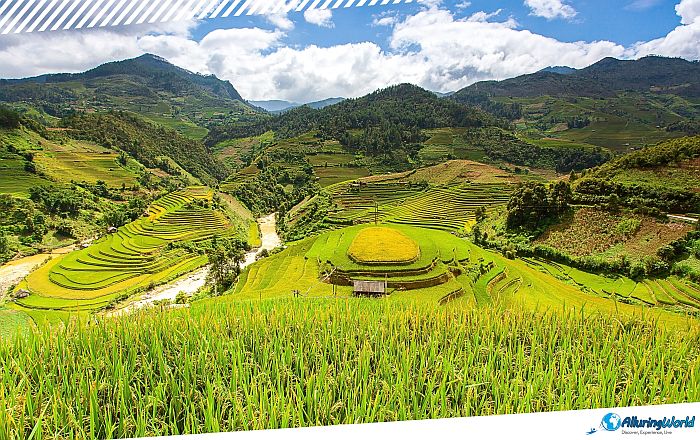
This is an amazing opportunity to see firsthand the farming process as families use water buffalo to plow the land and plant the bright green rice plants. The growing season, on the other hand, which runs from July to August, is when the young rice plants take root, turning the entire region into a lush panorama of deep greens. While less frequented by international tourists, these months offer cool mountain breezes, dramatic cloud formations, and quiet, uncrowded trekking trails. Finally, if you want to visit this place during the golden harvest season, locally referred to as Mùa Lúa Chín, which runs from September to October, it marks the most famous period in the region. As the crops mature, the hillsides shift from emerald green to a brilliant, shimmering gold, thus giving the usual colors that you see in brochures.
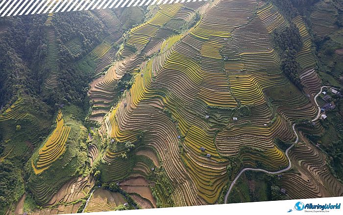
The air fills with the fragrant scent of ripening grain, and whole villages gather on the slopes to harvest the crop by hand. This season draws photographers and travelers from around the world to capture the vivid contrast between yellow fields, dark timber homes, and clear autumn skies. Although the whole area presents beautiful mountain views, there are particular spots that should not be overlooked when visiting the heritage area. Among those are:
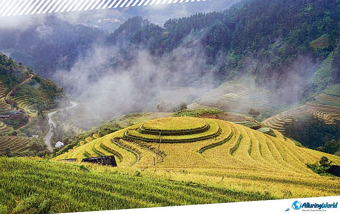
- Mâm Xôi Hill (La Pán Tẩn): Located in La Pán Tẩn commune, Mâm Xôi Hill, often translated as “Raspberry Hill” or “Tray of Sticky Rice,” is perhaps the most iconic viewpoint in northwestern Vietnam. The terraces here wrap around a perfectly rounded hilltop, creating a striking circular pattern that resembles a traditional plate of festive rice.
- Chế Cu Nha Commune: If you are seeking a rugged trekking experience away from the main roadside pull-offs, Chế Cu Nha features some of the steepest terraced inclines in the region. The trails here wind through deep valleys, offering panoramic views of fields that seem to hang almost vertically against the mountainside.
- Khau Phạ Pass: Khau Phạ is one of the four major passes of northern Vietnam and rises to a height of more than 1,200 meters (3,937 feet). This mountain pass is the gateway between the districts of Văn Chấn and Mù Cang Chải and affords a panoramic view of the Cao Phạ Valley lying on the other side. During the harvest season, Khau Phạ forms the base camp for the “Flying Over the Golden Fields” paragliding festival.
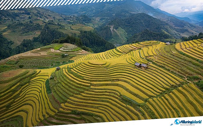
To the H’Mong ethnic minority, the terraces are not simply an impressive visual backdrop, but a vital part of their sustenance and economic security. Life on the terraces follows an annual calendar that determines many social events that the H’Mong people organize annually. The development of eco-tourism in the Yên Bái province has led to the development of secondary incomes through homestays, local guiding services, transport, and crafting. Yet, it is your duty as a tourist to move around responsibly without affecting the functioning of these farms.
- Respect Private Property: Always stay on the path, and do not walk on the edges of the wet terrace rims as they may crumble beneath your feet.
- Support the Local Economy: Choose community-based homestays in villages such as La Pán Tẩn or Kim Nọi, along with H’Mong guides who know the area well due to their experience.
- Cultural Etiquette: Always ask for permission before taking close-up pictures of the residents, particularly children, and never hand out sweets or money to the children on the trails.
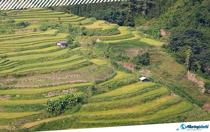
In summary, the district of Mù Cang Chải serves as a remarkable representation of human intelligence and sustainability that the local people have carved out throughout the decades. By transforming tough terrain into a sustainable source of food, H’Mong generations have shaped a heritage landscape that supports life, and it also gives back to the land where these communities live. So, visiting this magnificent place will offer you a glimpse into the everyday life of the locals and bring you closer to Vietnamese culture.