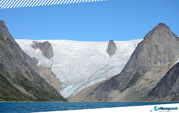
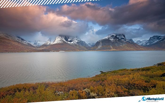
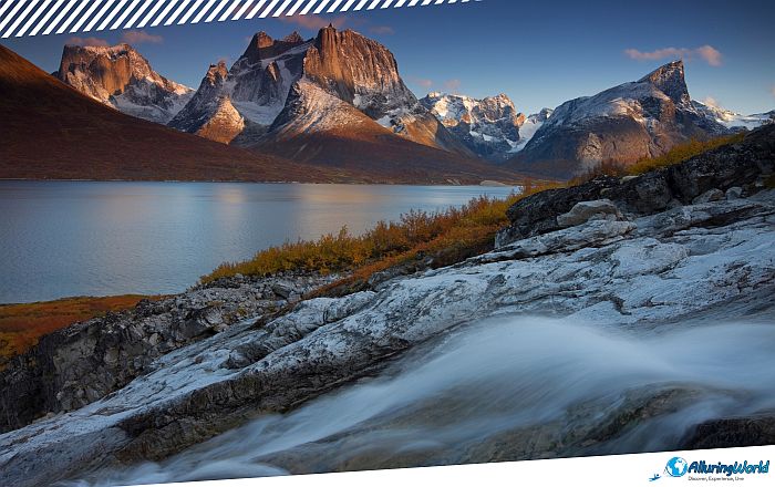
The Tasermiut Fjord is a dramatic and very long glacial inlet that is considered one of the most impressive fjords that can be found in the Kujalleq Municipality, within the southern part of the autonomous territory in the Kingdom of Denmark in North America, Greenland. As this fjord is neatly tucked away in the wild reaches of amazing Greenland, Tasermiut Fjord stretches 70 km (43 miles) from the open Atlantic deep into the mountainous interior of the municipality. Often referred to by world-class alpinists as the “Yosemite of the Arctic,” Tasermiut is a landscape of dramatic contrasts. Here, sheer granite monoliths shoot nearly vertical out of glassy, iceberg-strewn waters, surrounded by lush green valleys, rushing glacial rivers, and deep silence.
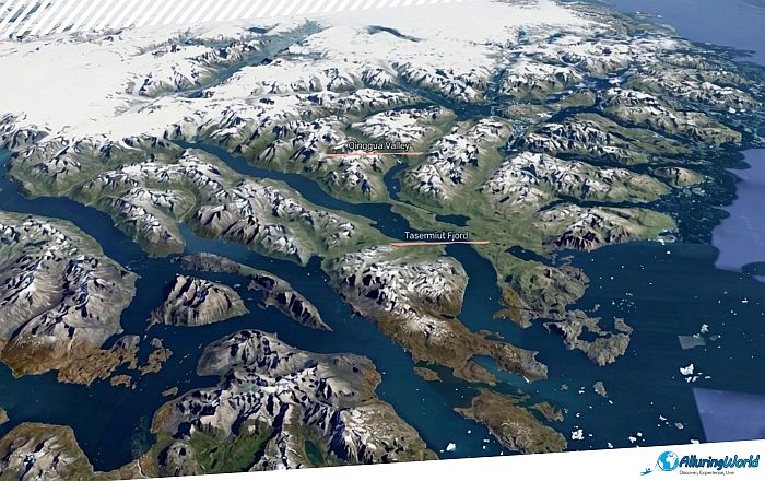
If you consider yourself a modern adventurer, eco-traveler, or sea kayaker, then the Tasermiut Fjord is the very rare treat that you might need. This is a place with pristine Arctic wilderness that is not spoiled by any commercial amenities, and it is rather seen as an untouched spot in Greenland. Getting into this natural cathedral involves plenty of planning, but once there, you will find out that the Tasermiut Fjord is among the world’s best for big wall climbing and wildlife watching. The history of the Tasermiut Fjord dates back several million years, as it is grounded on the Precambrian shield that makes up the bedrock of Greenland. Despite this, the impressive scenery that you can see in Tasermiut today was formed in the Pleistocene Ice Ages. Over millennia, the huge glaciers gouged their way through the hard rock, thus carving a deep, steep-sided trough into the Earth’s crust.
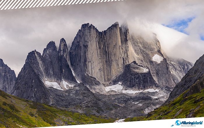
With the retreat of the last glacial maximum about 10,000 years ago, seawater began to fill up the valley, creating a 70 km (43 miles) long fjord with cliffs and spires towering above it. The combination of the older rocky formations and younger glacial features contributes to Tasermiut’s distinct visual impact. Standing guard over the eastern shore of the fjord are three of Greenland’s most famous mountain peaks:
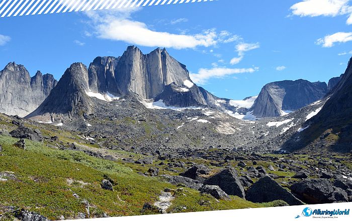
- Ketil (1,500 meters / 4,921 feet): Known for its towering, dark faces and complex alpine routes that test even veteran mountaineers.
- Ulamertorsuaq (1,858 meters / 6,095 feet): Renowned globally for its West Pillar, considered one of the hardest big-wall traditional climbs on the planet.
- Nalumasortoq (2,056 meters / 6,745 feet): Famous for its distinct open-book double-wall structure that resembles a giant, unwritten book rising straight toward the Arctic sky.
While Tasermiut Fjord is best known for its cold water and barren vertical rock, the region harbors one of Greenland’s greatest ecological anomalies: the Qinngua Valley, sometimes referred to as Paradise Valley. Branching off from the main fjord network near Tasersuaq Lake, this 15 km (9.3 miles) valley contains Greenland’s only natural forest, and the valley enjoys a unique microclimate that fosters conditions mild enough to support over 300 plant species, including native downy birch (Betula pubescens) and gray-leaf willow (Salix glauca) that reach heights of 6 meters (20 feet) to 8 meters (26 feet). If you are trekking through the fjord, then a trip to the Qinngua Valley is something extra to consider because you will see a stark, striking transition from the sub-Arctic tundra into a dense, green woodland setting found nowhere else on the island.
Even though Tasermiut Fjord remains unoccupied by any permanent settlement, the fjord’s role was significant in the survival of the Greenlanders throughout the years. This fjord has been an essential source of resources for the Inuit people of Southern Greenland; with its calm waters, the people could fish the Arctic char, while the lowland areas around it have been rich in vegetation and mammals that could be hunted. Another function of the fjord has been as a route for sea kayakers who wanted to avoid traveling on the open Arctic Ocean.
ADVERTISEMENT
In the late 10th century, Norse explorers established the Eastern Settlement in the southern part of Greenland under the command of Erik the Red, thanks to their discovery of the area. The fertile river valleys adjacent to Tasermiut Fjord had been serving as excellent summer grazing land for their herds. Norse ruins still remain visible across the landscape today, including the historic site at Klosterdal near the head of the fjord, where Augustinian monks once operated a monastery retreat. Today, you can notice that there are archaeological remains of Inuit winter houses as well as Norse stone turf structures alongside the shoreline, thus serving as quiet reminders of the human resilience that is required to thrive in this formidable environment.
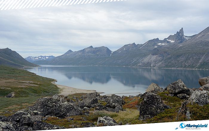
Tasermiut Fjord has achieved a global reputation as an outdoor playground within the Kujalleq Municipality, accessed primarily through the gateway town of Nanortalik, with activities that can be done from mid-June to early September. Unlike heavily managed national parks in Europe or North America, the Tasermiut Fjord provides self-sufficient backcountry adventures where routes are unmarked, navigation requires skill, and total self-reliance is mandatory. The most intriguing and adventurous activities you can do in this fjord are:
- Big-Wall Alpinism: Mountaineers from all around the world come to conquer the granite walls of Tasermiut. The granite in this region is excellent, dense, with friction and continuous systems of fissures. The season for climbing is at its best in July and August when daylight hours stretch almost infinitely, therefore permitting climbers to finish their multi-pitch climbs even after 22:30 without using any lighting equipment.
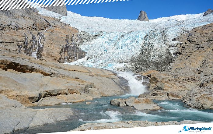
- Backcountry Trekking: The hikers have access to a range of hiking options with spectacular scenery, such as unmarked tundra trails, lakes formed by glaciers, and panoramic viewpoints. One particular hike ends right at the edge of Tasermiut glacier, through which the Greenland Ice Sheet flows from the ridge to the water.
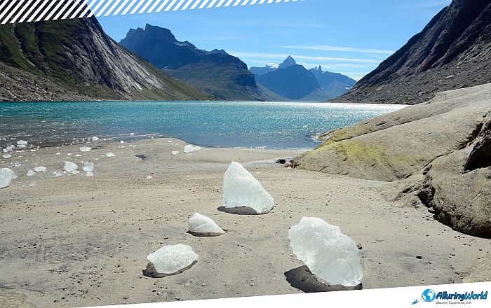
- Sea Kayaking: Kayaking through the full extent of the Tasermiut Fjord is considered one of the best Arctic sea kayaking trips. Moving through tranquil fjord waters, surrounded by towering cliffs that exceed 1,000 meters (3,280 feet) in height provides a unique experience. Kayakers often find themselves in the company of ringed seals, harbor seals, and icebergs formed from melting glaciers in the upper part of the fjord.
Reaching the Tasermiut Fjord will require some preparation because no roads link any of the communities of Southern Greenland. Transportation within the fjord is only possible through charter vessels, sea kayaks, or local guide transfers. The Tasermiut adventure starts with either Narsarsuaq Airport or Qaqortoq in South Greenland. Once there, you will then use passenger ferry services or helicopters from Narsarsuaq to fly southwards to Nanortalik, which is the southernmost town in Greenland. Located close to the mouth of the fjord, Nanortalik acts as the main point of departure for expeditions. From the harbor, boat captains usually leave the port around 08:00 to transport you to the fjord, a trip that takes about 1-2 hours, depending on sea conditions and ice density.
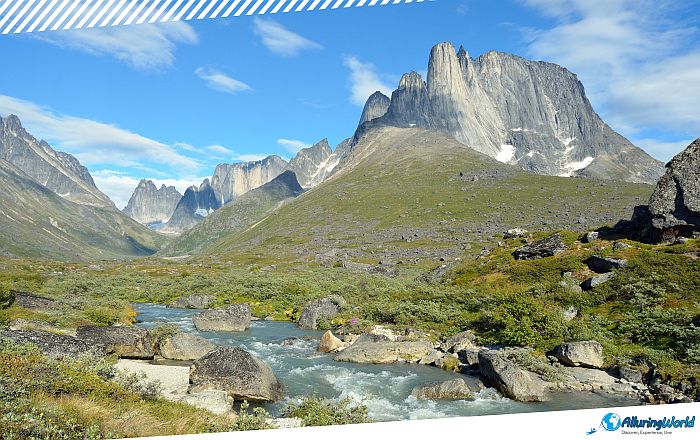
There are only a few months available to experience Tasermiut Fjord, which extend from June to September. Early in the season, there will be ice melt, and the sea will clear, with temperatures at around 5°C (41°F). The months of July and August bring the peak summer warmth at a comfortable 15°C (59°F) in the sheltered valleys. By September, you’ll notice crisp air and golden tundra foliage, but this is the period when the nights return, offering the first seasonal glimpses of the Northern Lights dancing over the granite spires.
When you are traveling in the Arctic wilderness, you need to be extra careful, as this carries inherent risks. Because there is no cellular reception in the Tasermiut Fjord, permanent emergency shelters, or paved roads, you must take full responsibility for your safety and the environmental impact your trip will have. This is why you must be aware of the following:
- Carry Satellite Communication: Always pack a satellite messenger (such as a Garmin inReach or Personal Locator Beacon) for emergency communications and weather updates. You never know when you will need to call someone, whether that is an emergency or to request additional provisions.
- Prepare for Sudden Weather Shifts: Arctic weather changes rapidly. Föhn winds cascading off the ice sheet can generate sudden, powerful gale-force gusts down the length of the fjord. Pack robust four-season tents and high-grade waterproof gear.
- Practice Cold-Water Safety: Since the fjord is part of the Labrador Sea, which is a marginal sea of the North Atlantic Ocean, its waters hover around 2°C to 4°C (35°F to 39°F). Kayakers and boaters must wear full drysuits and personal flotation devices at all times; immersion hypothermia can set in within minutes.
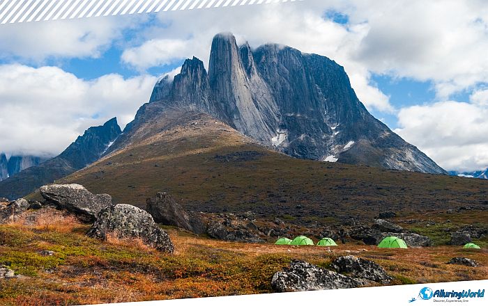
Overall, the Arctic ecosystem of Tasermiut Fjord is delicate and more vulnerable than ever due to climate change affecting the planet. The glaciers feeding the upper reaches of the fjord have receded significantly in recent decades, threatening the delicate local hydrology and surrounding tundra ecosystems. You should respect the strict “Leave No Trace” policy of carrying away all trash to Nanortalik and camping only on hard surfaces like gravel or turf in order not to damage slow-growing mosses and lichens.
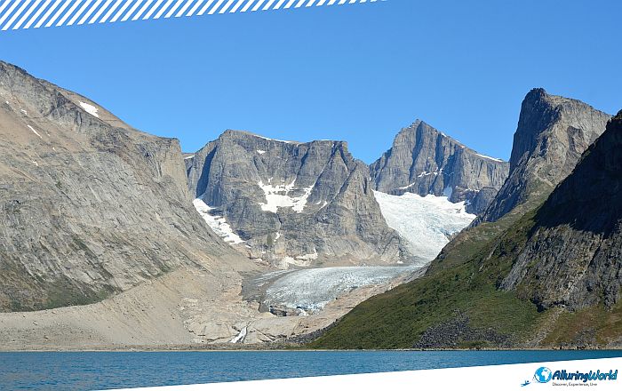
In summary, Tasermiut Fjord is still considered to be one of the world’s greatest havens of wilderness; one made by the work of glaciers, steeped in the heritage of Inuit civilization for generations past, and held sacred by today’s adventurers. When standing at the edge of Klosterdal during sunset as the last sun rays glow over Ulamertorsuaq, or looking out across the rare canopy of the Qinngua Valley, all noise of modern life melts away into a perfect silence. For those who are prepared to make the journey to the southern section of Greenland, Tasermiut has so much more to offer besides its beauty and majestic sights, and it is something that should not be missed when in Nanortalik.