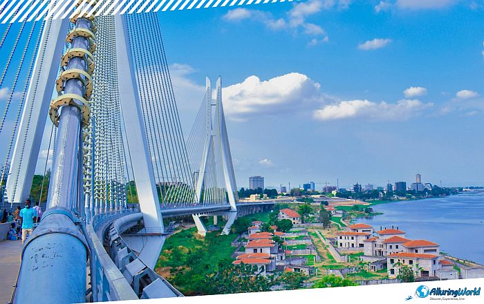
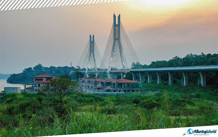
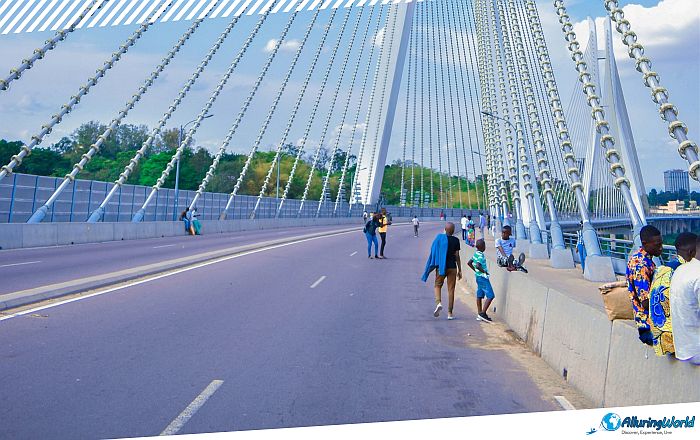
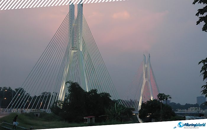
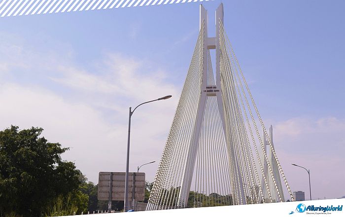
The Pont du 15 Août 1960, sometimes referred to as Pont de la Corniche, is a prominent and modern cable-stayed bridge located in the major urban and waterfront development project La Corniche, in the southern part of the city of Brazzaville, the capital and largest city of the Republic of the Congo. Spanning the waters of the Djoué River, the bridge is known in English as the Bridge of 15 August 1960 or the Bridge of the Corniche, and it stands as one of the most vital transportation conduits and symbolic landmarks in the Republic of the Congo. Named directly in honor of 15 August 1960, the historical moment the nation broke free from French colonial administration, the structure bridges more than just physical riverbanks. It represents a living link between a complicated colonial past and an ambitious post-independence identity. Although most itineraries to Central Africa emphasize visiting the lush UNESCO-protected rainforests of Odzala-Kokoua National Park or the unspoiled wildlife of the Congo Basin, a true appreciation of Central Africa is only gained by witnessing the engineering wonders of its cities.
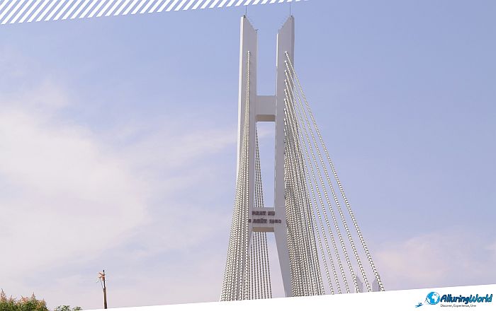
Brazzaville, found across the large Congo River from Kinshasa, is a place known for its rivers, artistic community, and architecture dating back to the mid-century. Amidst this fast-paced city environment, the Pont du 15 Août 1960 plays the role of a commuter artery used by many people every day. This is not just a structure made of concrete, but the bridge itself plays a key role in the everyday lives of the Congolese people, and it is thus a great place for tourists interested in the political history of Africa. The structural position of the Pont du 15 Août 1960 is firmly rooted in the particular geography of the southwest of Brazzaville, as the bridge spans the Djoué River, which is a large tributary flowing through rough greenery before meeting the powerful Congo River at the Cataractes du Djoué, notorious for their tumultuous rapids. In this area, there is an interesting contrast between dense vegetation and rocks, as well as urban expansion and roads.
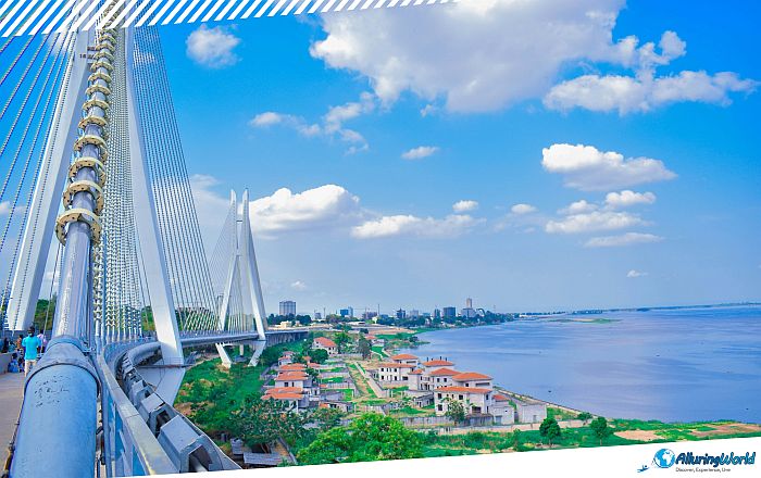
Nevertheless, the view from the bridge provides a panoramic sight of the native ecosystem of the Congo Basin slowly encroaching on the edges of the city. The river below runs with remarkable strength, especially after the tropical rains, against the background of green palms, bushes by the riverside, and the changing skyline of the capital. One of the more important details you should know about this is:
- Metropolitan Transit Gateway: The bridge is an important link as it connects downtown business districts to the southern outskirts and key routes to the coastal town of Pointe-Noire.
- Hydrographic Significance: Located immediately upstream of the Djoué’s confluence with the Congo River, the bridge represents the transition zone between tranquil urban rivers and raging rapid waterways.
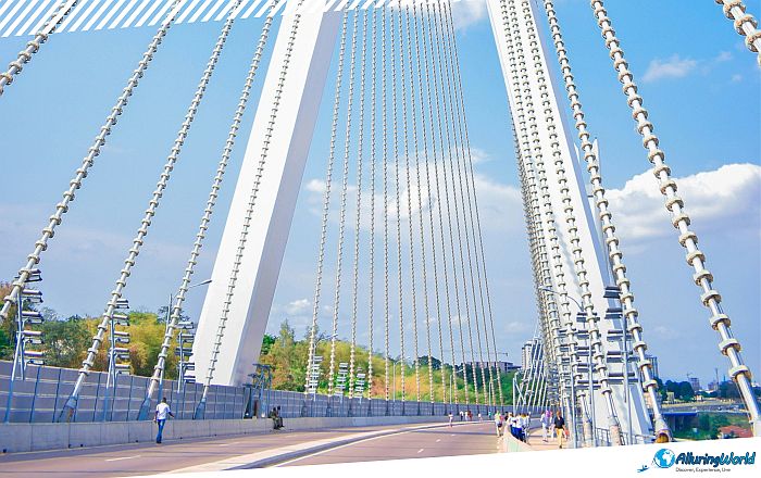
The importance of Pont du 15 Août 1960 will only be understood after comprehending the significance of the name given to it. On 15 August 1960, the Republic of Congo declared its independence from French rule, which had lasted for many years as French Equatorial Africa (Afrique équatoriale française). The country’s first President was Fulbert Youlou, and since then, Congo has entered a new era full of hope and aspirations of progress. In the years that followed the country’s independence, the civic infrastructure across Africa carried dual meanings. The roads, hydroelectric power plants, and bridges were not only meant to meet the basic logistics needs but were also supposed to reflect the success of the sovereign state in terms of infrastructure. The bridge’s naming after Independence Day turned the utilitarian bridge into a national monument. The act of commuting on it becomes a constant reminder of national sovereignty for the Congolese nation.
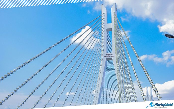
The Pont du 15 Août 1960 began construction at the end of 2013, and it took roughly 2 years and 4 months to finish construction; it was officially opened and inaugurated on 5 February 2016. The bridge is 545 meters (1,788 feet) long, and it was built to design specifications that were durable enough to withstand the conditions in the humid tropical region of Central Africa. The piers that support the bridge are made of reinforced concrete and have been set firmly in the bed of the Djoué River to accommodate the heavy vehicular traffic and high water volumes during the peak equatorial rainy seasons.
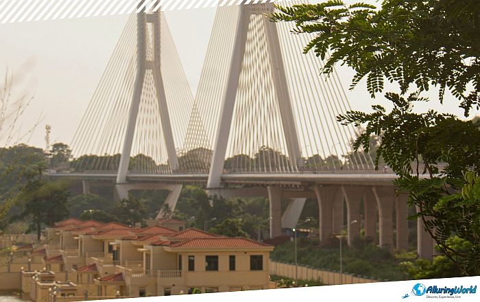
With the construction of this important link, civil safety increased, and even regional commerce was improved when the bridge replaced older, less reliable river crossings. Nowadays, traffic gets busy starting at 06:30, as taxi-brousse minivans, private automobiles, motorbikes, and pedestrian vendors cross from the residential southern edges into the central business districts. Interestingly enough, the reinforced bridge is enduring 1,500 cubic meters (52,972 cubic feet) per second during flood stages. To increase the safety of pedestrians, there are dedicated raised walkways along both flanks of the bridge, thus allowing safe foot traffic for residents and urban explorers.
ADVERTISEMENT
If you are visiting Brazzaville, you will have a rewarding experience, provided that you approach the city with proper preparation and cultural sensitivity. The Pont du 15 Août 1960 can easily be incorporated into an independent walking tour or a half-day private vehicle excursion through the capital’s historic southern arrondissements. Since the Republic of the Congo experiences a tropical wet and dry climate, the most comfortable periods for exploring the capital on foot are during the long dry season from June through September, and the shorter dry spell in January and February. During these months, you should expect the average daily temperatures to hover comfortably between 22°C (72°F) and 30°C (86°F), accompanied by lower humidity and minimal rainfall. If you want to capture the 15 August 1960 Bridge in its best ambient light and see the peak of foot and vehicular traffic, then you should consider visiting between 07:00 and 09:00 in the morning, or in the late afternoon around 16:30. The golden hour light reflecting off the Djoué River provides beautiful backdrop conditions for visual observation.
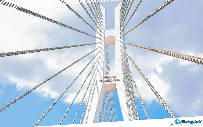
When you are there, you should be aware that photographing public infrastructure in the Republic of the Congo requires caution. Bridges, government buildings, military checkpoints, and police personnel are subject to strict security regulations. Because of this, you should be aware of the following:
- Seek Verbal Authorization: If you see a local municipal officers or nearby residents, consider asking for permission before framing shots that include civic structures or individuals.
- Focus on Nature and Context: You should not point your camera directly at people, but rather toward the natural landscape of the Djoué River and surrounding flora. Otherwise, you’re risking taking close-up shots of traffic control points or security infrastructure, which could bring you trouble.
A visit to the Pont du 15 Août 1960 fits naturally into a broader day trip exploring the historical, architectural, and artistic landmarks of Brazzaville. Since this is a place that will take you about half an hour to see in person, after visiting it and taking in the river views, several major points of interest are located just a short drive away:
- Basilique Sainte-Anne du Congo: Set in the city center, this incredible cathedral is renowned for its beautiful emerald green tiled roof and the integration of both the Gothic style architecture seen in Europe and native designs. This religious structure was erected at the end of the 1940s.
- The Pierre Savorgnan de Brazza Memorial: Positioned near the banks of the Congo River, this marble mausoleum and cultural center houses the remains of the Franco-Italian explorer after whom the capital was named. The site provides essential context regarding the colonial history of the region and the founding of the city.
- Poto-Poto School of Painters: Art enthusiasts mustn’t miss the Poto-Poto artists’ studio, famous throughout the world. Since its founding in 1951, it has been creating unique and stylized paintings that have become an inspiration for modern African art.
When you’re preparing for your trip to the Congo, you should consider its location, safety, and other important details, like currency, food, transportation, etc. When you build your itinerary to explore the riverfront landmarks of Brazzaville, keep these practical safety guidelines in mind:
- Hydration and Sun Protection: Even under cloudy skies, the tropical sun can be very harsh. When walking and exploring the city on foot, always carry at least 1.5 liters (0.4 gallons) of bottled water for each individual.
- Local Transportation: Use registered green and white city taxis to get to the Djoué River area. You will need to make sure that you have agreed on the cost of the ride before you set off, since there is no meter system in use here.
- Urban Safety & Vigilance: Brazzaville is generally believed to be a much safer city than its counterparts in the region, but tourists are advised to adhere to basic safety tips such as refraining from traveling at night in unfamiliar places, carrying identification papers, and booking hotel transport.
Being at the edge of the Djoué River and looking at the daily bustle going over the Pont du 15 Août 1960 is truly a way of understanding the identity of the Republic of the Congo. This bridge is not just a functional bridge but also one that has been written about in the daily life of the capital city through a monumental leap towards independence. In summary, Pont du 15 Août 1960 remains a highly symbolic landmark in Brazzaville that blends utility with history. Named in honor of the independence day of the Republic of Congo, the bridge acts as a sign of the nation’s pride and modernization, as well as its development. The bridge crossing the Djoué River serves as a reminder of the link between the city’s development and the geographical environment of the Congo Basin. When you are visiting Brazzaville, the bridge serves as an insight into the history of the nation from its colonial past to the present day.