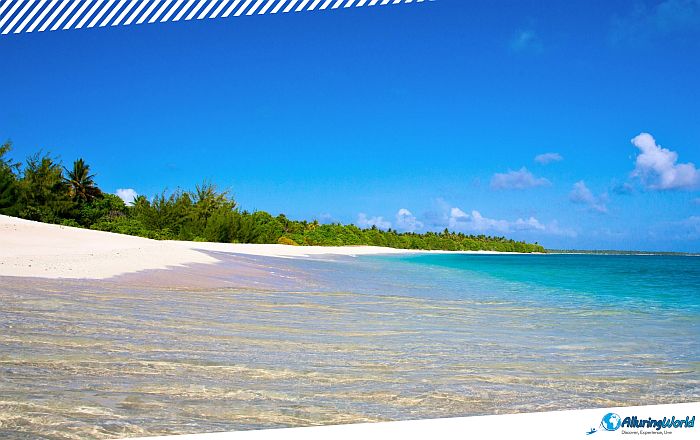
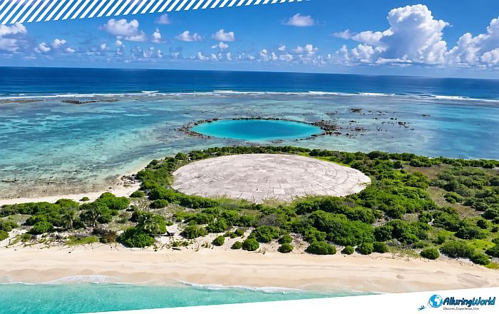
Enewetak Atoll, sometimes spelled and referred to as Eniwetok Atoll or sometimes Eniewetok, is a large coral atoll that has a history of events that happened on it, part of the Ralik Chain in the central Pacific Ocean, within the northwestern part of the Republic of the Marshall Islands. As Enewetak Atoll stands as one of the most remote and geographically striking island groups in the Marshalls, this sprawling coral formation comprises approximately 40 small islets that encircle a vast, deep-blue lagoon. The atoll encompasses a modest land area of just 5.8 square kilometers (2.2 square miles), yet it cradles an immense marine basin spanning roughly 800 square kilometers (309 square miles). Such stark juxtaposition of tiny strips of land with a huge expanse of water is the very nature of the atoll, which brings together pristine beaches, dangerous reef flats, and thorny vegetation along its coastline.
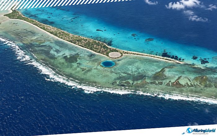
The landscape is influenced by a maritime tropical climate that is defined by hot conditions throughout the year, high levels of humidity, and prevailing trade winds blowing through the islands. Vegetation consists of hardy scrub and salt-resistant vines, all the way up to coconut and pandanus palms that offer shade and natural resources to the native fauna. The surrounding marine ecosystem is exceptionally rich, featuring barrier reefs, patch reefs, and drop-offs that harbor a diverse array of scleractinian corals, reef fish, and pelagic species. The daily cycle and natural cycles on these inhabited islands have much to do with these environmental patterns, whereby local fishermen tend to leave their boats as early as 05:30 in preparation for catching fish during the morning high tide.
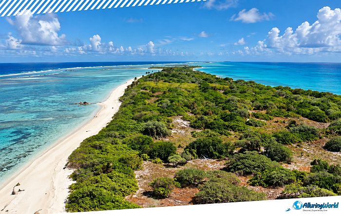
Though it looks as though it is an idealized tropical paradise, the Enewetak Atoll is known worldwide for playing a crucial role in the history of modern military warfare. Before Enewetak became a testing ground for the atomic age, its strategic importance was cemented during World War II, when U.S. forces captured the atoll in a fierce amphibious assault known as the Battle of Eniwetok in February 1944. The American decision to use the atoll as a site for nuclear bomb experiments was made shortly after the end of World War II. From 1948 to 1958, there were 43 nuclear detonations, completely reshaping the geography, environment, and even the history of the area. The testing pushed the limits of military technology to reshape the landscape of the northerly islands forever, thus turning it into a stark monument to the atomic age.
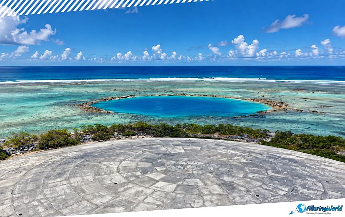
The height of activity in this period was reached on 1 November 1952, when “Operation Ivy” took place. Exactly at 07:15 local time, the USA tested “Ivy Mike,” the world’s first full-scale thermonuclear hydrogen bomb. The enormous power of the explosion, which was equal to 10.4 megatons, completely destroyed the small island of Elugelab and formed a huge underwater crater with a diameter of more than 1.9 kilometers (1.2 miles). Further testing periods over the next decade led to the further transformation of the atoll, destruction of vegetation, damage to coral formations, and distribution of radioactive isotopes in soil, groundwater, and sea sediments.
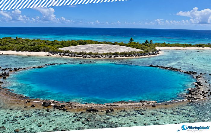
As the Cold War test period was nearing, efforts were made towards remedying the environmental damage and determining the possibility of people’s return to the site. From 1977 through 1980, the U.S. government launched the Enewetak Cleanup Project, which was a massive logistical project that required the participation of thousands of military members. This operation ran on tight schedules that often started with equipment check-ups at 06:00. Contaminated soil was removed from different islands and transferred to Cactus Crater on Runit Island.
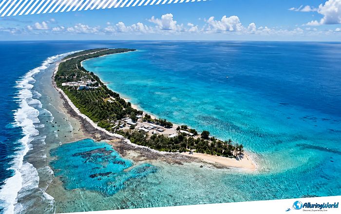
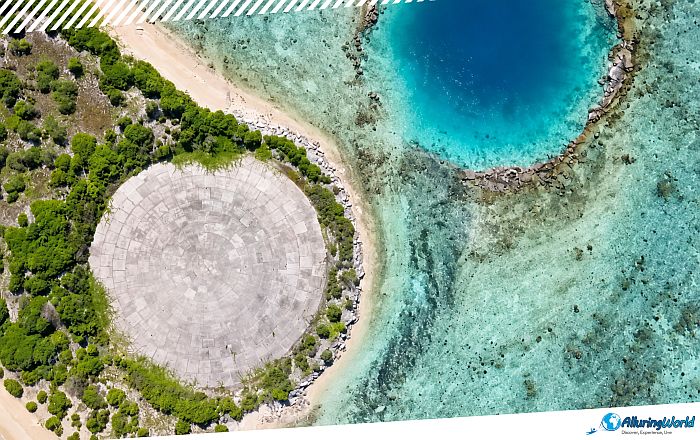
The focal point of this remediation project is the Runit Dome, which is also known as the “Cactus Dome.” The dome was constructed inside the crater created by the detonation of the May 1958 Cactus nuclear bomb; it is 115 meters (377 feet) in diameter and comprises 358 concrete panels. Inside, workers deposited over 84,865 cubic meters (111,000 cubic yards) of irradiated soil, military debris, and plutonium-contaminated waste, sealing it beneath an unlined bed and a 46-centimeter (18-inch) thick concrete cap. While the dome effectively segregates a large volume of dangerous surface waste, the environmental scientists, regional delegates, and international monitors continue to keep a close watch on groundwater seepage, tidal erosion, and weathering of the structure.
ADVERTISEMENT
Compounding these nuclear legacy concerns are the modern pressures of global climate change, as rising sea levels and intensifying tropical storm surges present ongoing environmental anxieties regarding the long-term structural resilience and containment integrity of the unlined dome. As there is still subsurface contamination, Runit Island and the northern islets are not available for human settlement, and movement here is limited to certain parties.
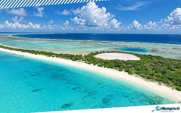
The story of Enewetak from the human point of view is characterized by displacement and resilience. Forced to relocate before the nuclear tests began, the native population and their descendants endured a difficult 33-year exile on the remote, resource-poor Ujelang Atoll hundreds of kilometers away, before finally beginning a historic process of repatriation in 1980 to return and settle the southern and central islands, including Enewetak and Parry. The creation of a community on the island was associated with adaptation to the changed environment and use of supplies imported from outside, U.S. trust and compensation funds, and subsistence activities.
The people living there manage their survival through artisanal fishing, small-scale production of copra, and gardening, while their culture is based on tradition, churches, and community governance. Inhabitants of the atoll usually end their day around 18:00 when the trade winds begin to blow, and they sit to have dinner and talk about different things. It is important to observe all the rules of health and community life while living on an environmentally remediated atoll, so you should be aware of:
- Respect restricted areas: Always adhere strictly to off-limit zones in the northern sector due to ongoing environmental containment measures.
- Engage respectfully with local leaders: Coordinate cultural protocols through the local council when visiting inhabited southern islets.
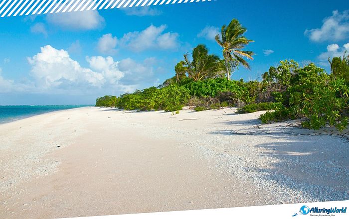
A visit to Enewetak Atoll is a voyage for passionate historians, researchers, and specialized tourists due to the remoteness of the place and its restrictive access. In other words, there are no commercial airplanes or passenger ferries operating at this place. Visiting it presupposes obtaining permission from the Marshallese Government, along with organizing private transportation, usually by means of specialized vessels or planes that take off from Majuro, which is the capital city of the country. It is advisable to make the trip at 08:00 in the morning.
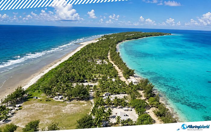
Once there, the atoll provides an incredible mix of pristine nature with deep history for anyone allowed entry into it. The south and center parts provide a typical example of Pacific lagoon ecosystems, while remains from mid-20th-century structures and test sites provide a reminder of the world’s changing geopolitics. Once you are there, you can concentrate on these main points:
- Central Lagoon Snorkeling: To experience this interesting place to the fullest, you can go snorkeling in the controlled southern lagoon areas.
- Historical Reflection: When you are at the Runit Dome, you will be able to see the destruction people can do, as well as see the remnants of mid-century military installations and understand the profound environmental legacy firsthand.
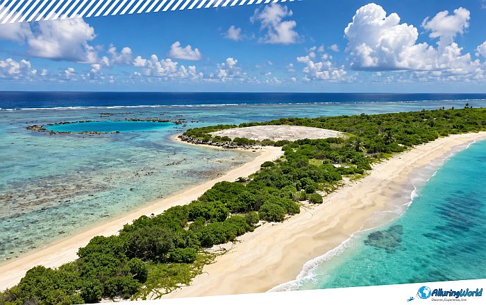
Overall, Enewetak Atoll is still one of the greatest paradoxes in the Pacific region; a place which combines spectacular natural beauty and serious wounds inflicted by the process of nuclear experiments. Ranging from the delicate ecosystem of corals and the sea wildlife to the massive structure of Runit Dome, Enewetak Atoll is not only the source of life for a diverse range of species, but also a historical landmark. The strength of the Marshallese people in reclaiming their homeland and keeping it alive proves the close relationship between the people and their environment.